Project Title: Experimental mapping of coastal habitats using small airborne remote-sensing technology
Principal Investigators: Hanu Singh, WHOI, David Fisichella, WHOI, Jim Rassman, WBNERR
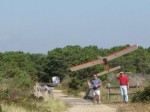
Summary: WHOI scientists are working with Reserve staff, using a small hobby-plane equipped with GPS and camera to take high-resolution photos of the salt marsh and shore at South Cape Beach. These photos are useful for public presentations, but more importantly can map change over time, damage from storms, results of controlled burns, animal populations (such as seals), etc. 

