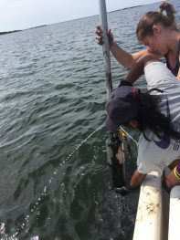
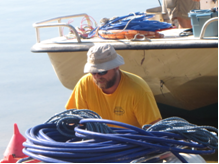
Quantifying groundwater nutrient inputs and their impacts to Waquoit Bay estuaries
Project Title: Quantifying groundwater nutrient inputs and their impacts to Waquoit Bay estuaries
Duration: May-2024 to August-2024
Funding Source(s): Various educational programs at MBL, including the Logan Science Journalism Program, the NSFREU Biological Discovery in Woods Hole Program, the University of Chicago Metcalf Summer Internship Program, and the Brown-MBL LINK Internship Program.
Principal Investigator info: Lead investigator: Javier Lloret, Marine Biological Laboratory, Email: jlloret@mbl.edu
Onsite-contact: Kelsey Chenoweth, Marine Biological Laboratory, Email: kchenoweth@mbl.edu
Project Description: Lloret, together with several groups of students, interns, and faculty from several educational programs at the Marine Biological Laboratory, will be developing projects aimed at understanding the effects of excess nutrient loadings on ground- and estuarine water quality, and their impacts on the food webs of the various Waquoit Bay estuaries. They will define links between nitrogen loads from shifting land use and atmospheric deposition for the region, groundwater nitrogen concentrations, and water quality indicators in selected receiving estuaries. They will examine how excessive nitrogen loads alter the composition and structure of estuarine food webs. Waquoit Bay’s range in nitrogen loads will serve as a wider context within which to place data from other local estuaries.
Seasonal changes in Salicornia depressa metal accumulation and rhizosphere composition
Seasonal changes in Salicornia depressa metal accumulation and rhizosphere composition
Duration: June 2023—September 2023
Funding Source: Startup grant from the University of Massachusetts Boston to B. Moyers
Principal Investigators, institutional affiliation: Brook Moyers / Alice Palmer
Affiliation: University of Massachusetts Boston, Biology
Email: brook.moyers@umb.edu, alice.palmer001@umb.edu
Project Description: Salicornia species, known in New England as pickleweeds, form mutually beneficial relationships with soil microbes living on the plant’s roots (the rhizosphere), which can help improve plant growth under stressful conditions. They are also capable of accumulating metals from the soil at high concentrations. We are studying how the bacteria present in the Salicornia depressa rhizosphere differ from those in the soil surrounding the plant. We also are interested in how changes in the plants’ biology over the course of the growing season and seasonal changes in salt marsh soil chemistry affect both the rhizosphere’s composition and its ability to accumulate metal from soil. To investigate this, we are collecting samples of S. depressa, its rhizosphere, and the surrounding soil in June, before the plants begin to flower, in August, as they are flowering, and in September, as they begin to senesce. We will sequence bacteria in the rhizosphere and surrounding soil for each timepoint. We will also test the amount of metal in the soil, in S. depressa’s roots, and in S. depressa’s shoots at each timepoint to determine how much metal the plant is accumulating and where it is being stored. These results will help us understand how S. depressa copes with metal stress and its potential in removing metals from polluted marshes.
Effects of sea level rise on maritime forest dieback
Project Title: Effects of sea level rise on maritime forest dieback
Duration: July 2020-July 2021
Funding Source(s): NSF
Lead Investigator: Elizabeth Watson
Affiliation: Drexel University and the Academy of Natural Sciences
Email: elizabeth.b.watson@gmail.com
Project Description: This project will analyze groundwater patterns, salinity, and plant stress using mapping of near-infra spectral indices
to address knowledge gaps in our understanding of the impacts of sea level rise to maritime forests. We are focusing
on understanding the proximate causes of forest dieback by building robust and complementary geospatial datasets
focusing on key hydrologic factors and plant stress indicators. This project also involves study sites in New Jersey
and New York and aims to focus on identifying whether salinity or flooding thresholds exist in terms of driving
forest die-off as well as how local factors such as geology and sediment permeability alter these factors.
Forecasting Rates of Sediment Nutrient and Metal fluxes under Coastal Acidification
Title: Forecasting rates of sediment nutrient and metal fluxes under coastal acidification for improved estuarine water quality
Year: 2020-2022
Principal Investigator/contact information:
Claudia I. Mazur (she/her)
Ph.D. Candidate, Fulweiler Lab
NOAA Margaret A. Davidson Fellow
Earth & Environment, Boston University
Email: cmazur@bu.edu
Lab Website: fulweilerlab.com
 Abstract: Coastal acidification refers to the reduction in pH of coastal waters. Unlike the open ocean, coastal acidification is driven by excess nitrogen (N). This N fuels primary productivity and the subsequent decomposition of this organic matter lowers estuarine pH. In fact, estuaries experience pH shifts of ≥ 0.5 daily. Thus, estuaries are natural laboratories in which to study how acidification alters fundamental ecosystem processes such as nutrient filtration and cycling. The purpose of this research is to determine the impact of coastal acidification on sediment N, phosphorus (P), and iron (Fe) cycling. To address this issue, I will experimentally manipulate pH in the overlying water column of sediment cores collected from Waquoit Bay, MA. Using continuous flow through incubations, I will quantify rates of sediment denitrification (microbial removal of N to di-nitrogen gas), N, P and Fe fluxes. I will use these findings and data from the WBNERR System-Wide Monitoring Program to develop a model that will predict the impact of low pH conditions on these fluxes and future water quality in Waquoit Bay. This study will be a crucial link to understanding how coastal acidification alters total ecosystem productivity, biogeochemical cycling and water quality.
Tackling microplastic pollution in Waquoit Bay
Project Title: Tackling microplastic pollution in Waquoit Bay
Date: 2019 Principal Investigator(s): Javier Lloret , Rut Pedrosa-Pamies
Affiliation: Marine Biological Laboratory
Link to Cape Cod Times article: https://www.capecodtimes.com/news/20190810/tackling-microplastic-pollution-in-waquoit-bay
Additional Resources: Salt marsh sediments act as sinks for microplastics and reveal effects of current and historical land use changes. Microplastic particles are widespread in marine sediments and the abundance of the different types of particles vary widely. In this paper we demonstrate (read the full article).
Spatial variability of carbon export from tidal marsh drainage
Project Title: Spatial variability of carbon export from tidal marsh drainage
Date: 11/2018-8/2019
Principal Investigator(s): Joseph Tamborski
Affiliations: Woods Hole Oceanographic Institution
Summary: Salt marshes provide significant environmental and economic value by shielding coastal communities against storm-surges and sequestering CO2 from the atmosphere, acting as a natural buffer to climate change. Carbon is both buried by marsh plants and exported to the coastal ocean from tidal drainage. However, the spatial variability of carbon export from tidal drainage across a salt marsh platform is largely unknown. Our two main objectives are to [1] characterize salt marsh hydrology under present and future climate scenarios; and [2] to determine the spatial and temporal variability of carbon export from tidal marsh drainage. Sediment cores, marsh pore waters and vertical temperature profiles will be sampled across marsh platforms, toward the tidal creek, to help reveal spatial patterns in seasonal exchange fluxes. Hydrogeological models will be used to assess salt marsh resiliency to changing climate scenarios. These tasks aim to reveal how salt marshes impact carbon cycling and biogeochemistry of the Northwest Atlantic and identify the vulnerability of these critical wetlands to changing terrestrial and marine conditions.
Coastal Soil Systems for a Changing Climate
Project Title: Coastal Soil Systems for a Changing Climate
Date: 9/2017
Principal Investigator(s): Mark Stolt and Amber Hardy
Affiliations: University of Rhode Island
Summary: Waquoit Bay sites were used in investigating the relationships between tidal marsh soils and their adjacent upland soils in the glaciated northeast, which will be important in the identification of marsh systems which are resilient to sea-level rise.
Ground Movement of a Salt Marsh due to Tidal Flooding and Draining
Project Title: Ground Movement of a Salt Marsh due to Tidal Flooding and Draining
Date: 1/2016-12/2019
Principal Investigator(s): Vitalii A. Sheremet
Affiliations:
Summary: While analyzing the water levels (at maximum tides) in pools and pannes developing at the Sage Lot Marsh due to the global sea level rise, we noticed discrepancies of up to 1 cm between some of the tide gauges (Sheremet and Mora, 2016: Precision Monitoring of Water Level in a Salt Marsh with Low Cost Tilt Loggers. In EGU General Assembly Conference) and hypothesized that they were caused by ground movement. We decided to instrumentally measure the swelling effect when the marsh is soaked up with water. We monitor water level and ground movement of the surface relative to deeper sandy levels and are developing a model that explains the soil properties, the relevant processes of marsh accumulation, and plant migration.
Biogeography of dinoflagellate cysts in northwest Atlantic estuaries
Project Title: Biogeography of dinoflagellate cysts in northwest Atlantic estuaries
Date: 2016
Principal Investigator(s): Price, A. M., Pospelova, V., Coffin, M. R., Latimer, J. S., & Chmura, G. L. (2016).
Publication: Ecology and Evolution, 6(16), 5648-5662.
http://onlinelibrary.wiley.com/doi/10.1002/ece3.2262/full
Sediment Nitrogen Fixation: a Call for Re-evaluating Coastal N Budgets
Project Title: Sediment Nitrogen Fixation: a Call for Re-evaluating Coastal N Budgets
Date: 2016
Principal Investigator(s): Newell, S. E., McCarthy, M. J., Gardner, W. S., & Fulweiler, R. W.
Affiliation:
Summary: Estuaries and Coasts, 39(6), 1626-1638. http://link.springer.com/article/10.1007/s12237-016-0116-y
Molecular evidence for sediment nitrogen fixation in a temperate New England estuary
Project Title: Molecular evidence for sediment nitrogen fixation in a temperate New England estuary
Date: 2016
Principal Investigator(s): Newell, S. E., Pritchard, K. R., Foster, S. Q., & Fulweiler, R. W. (2016).
Abstract: Primary production in coastal waters is generally nitrogen (N) limited with denitrification outpacing nitrogen fixation (N2-fixation). However, recent work suggests that we have potentially underestimated the importance of heterotrophic sediment N2-fixation in marine ecosystems. We used clone libraries to examine transcript diversity of nifH (a gene associated with N2-fixation) in sediments at three sites in a temperate New England estuary (Waquoit Bay, Massachusetts, USA) and compared our results to net sediment N2 fluxes previously measured at these sites. Read full text…PeerJ, 4, e1615. https://peerj.com/articles/1615/
Carbon dioxide fluxes reflect plant zonation and below ground biomass in a coastal marsh
Project Title: Carbon dioxide fluxes reflect plant zonation and below ground biomass in a coastal marsh
Date: 2016
Principal Investigators: Moseman‐Valtierra, S., Abdul‐Aziz, O. I., Tang, J., Ishtiaq, K. S., Morkeski, K., Mora, J., & Carey, J.
Summary: Coastal wetlands are major global carbon sinks; however, they are heterogeneous and dynamic ecosystems. To characterize spatial and temporal variability in a New England salt marsh, greenhouse gas (GHG) fluxes were compared among major plant‐defined zones during growing seasons. Carbon dioxide (CO2) and methane (CH4) fluxes were compared in two mensurative experiments during summer months (2012–2014) that included low marsh (Spartina alterniflora), high marsh (Distichlis spicata and Juncus gerardii‐dominated), invasive Phragmites australis zones, and unvegetated ponds. Read Full text…Ecosphere, 7(11). http://onlinelibrary.wiley.com/doi/10.1002/ecs2.1560/full
Sediment dynamics and hydrographic conditions during storm passage, Waquoit Bay, Massachusetts
Project Title: Sediment dynamics and hydrographic conditions during storm passage, Waquoit Bay, Massachusetts
Date: 2016
Principal Investigator(s): Maio, C.V., Donnelly, J.P., Sullivan, R., Madsen, S.M., Weidman, C.R., Gontz, A.M., & Sheremet, V.A.
Affiliations:
Summary: Marine Geology, 381, 67-86. http://www.sciencedirect.com/science/article/pii/S0025322716301438
Sediment nitrous oxide fluxes are dominated by uptake in a temperate estuary
Project Title: Sediment nitrous oxide fluxes are dominated by uptake in a temperate estuary
Date: 2016
Principal Investigator(s): Foster, S.Q., & Fulweiler, R.W.
Summary: Coastal marine ecosystems are generally considered important sources of nitrous oxide (N2O), a powerful greenhouse gas and ozone depleting substance. To date most studies have focused on the environmental factors controlling N2O production although N2O uptake has been observed in a variety of coastal ecosystems. In this study, we examined sediment fluxes of N2O during 2 years (2012–2013) in a shallow temperate estuary (Waquoit Bay, MA, USA). Read full text…Frontiers in Marine Science, 3, 40. http://journal.frontiersin.org/article/10.3389/fmars.2016.00040/full
Thin-layer sediment placement: evaluating an adaptation strategy to enhance coastal marsh resilience across the NERRS
Project Title: Thin-layer sediment placement: evaluating an adaptation strategy to enhance coastal marsh resilience across the NERRS
Lead Investigator: Dr. Kenny Raposa, Research Coordinator, Narragansett Bay National Estuarine Reserve
WBNERR Project Contact: Dr. Megan Tyrrell
8 Reserves Included in Project: Great Bay NH, Waquoit Bay MA, Narragansett Bay RI, Chesapeake Bay MD, Chesapeake Bay VA, North Carolina, Grand Bay MS, Elkhorn Slough CA
Summary: Tidal marshes provide key ecosystem services, but are threatened by sea level rise. Narragansett Bay and Elkhorn Slough NERRs recently led a project to assess marsh resilience to sea level rise across 16 NERR sites, resulting in a scientific publication, user-friendly summary, and DIY tool. Currently, eight NERR sites across the East, Gulf and West coasts are actively testing strategies to examine the effectiveness of thin-layer sediment placement as a climate adaptation strategy.
Novel aspects of our project include the broad geographic scale, the examination of effectiveness at different marsh elevations, standardized monitoring, and the incorporation of biochar as a soil amendment to enhance carbon sequestration. Beneficial use of dredged sediment to enhance coastal resilience is a concept that resonates in many coastal states, and we have interviewed end-users from eight states interested in funding, permitting, implementation or monitoring of thin-layer sediment projects.
CO2 Flux Sensor System
Anna Michel, Zoe Sandwith (WHOI)
Funding Source(s): WHOI
Flux measurements using the eddy covariance technique
Matthew Long, WHOI
Funding Source(s): WHOI
Distinguishing denitrifying organisms across gradients
2016
Robinson W. Fulweiler(Boston University); Teri O’Meara (University of Auckland)
Funding Source(s): Boston University, University of Auckland
Benthic biogeochemical responses to changing estuary trophic state and nutrient availability: A paired field and mesocosm experiment approach
Project Title: Benthic biogeochemical responses to changing estuary trophic state and nutrient availability: A paired field and mesocosm experiment approach.
Date: 2015
Principal Investigator(s): Spivak, A. C. (2015).
Abstract: To test how benthic biogeochemistry responds to changing nutrient availability and estuary trophic state, I conducted mesocosm and field experiments. In the mesocosm experiment, sediment cores from eutrophic and oligotrophic estuaries were incubated under high or low nutrient levels. Net production rates were greater in eutrophic vs. oligotrophic cores while respiration rates were greater in high nutrient treatments, indicating that sediment metabolism was affected by trophic history and nutrient availability. Read full text…Limnology and Oceanography, 60(1), 3-21. http://onlinelibrary.wiley.com/doi/10.1002/lno.10001/full
Oxygen metabolism and pH in coastal ecosystems: Eddy Covariance Hydrogen ion and Oxygen Exchange System (ECHOES)
Project Title: Oxygen metabolism and pH in coastal ecosystems: Eddy Covariance Hydrogen ion and Oxygen Exchange System (ECHOES)
Date: 2015
Principal Investigator(s): Long, M.H., Charette, M.A., Martin, W.R., & McCorkle, D.C.
Abstract: An aquatic eddy covariance (EC) system was developed to measure the exchange of oxygen (O2) and hydrogen ions (H+) across the sediment‐water interface. The system uses O2 optodes and a newly developed micro‐flow cell H+ ion selective field effect transistor; these sensors displayed sufficient precision and rapid enough response times to measure concentration changes associated with turbulent exchange. Discrete samples of total alkalinity and dissolved inorganic carbon were used to determine the background carbonate chemistry of the water column and relate the O2 and H+ fluxes to benthic processes. The ECHOES system was deployed in a eutrophic estuary (Waquoit Bay), and revealed that the benthos was a sink for acidity during the day and a source of acidity during the night, with H+ and O2 fluxes of ± 0.0001 and ± 10 mmol m−2 h−1, respectively. H+ and O2 fluxes were also determined using benthic flux chambers, for comparison with the EC rates. Chamber fluxes determined in 0.25 h intervals co‐varied with EC fluxes but were ∼ 4 times lower in magnitude. Read full text…Limnology and Oceanography: Methods, 13(8), 438-450. http://onlinelibrary.wiley.com/doi/10.1002/lom3.10038/full
In-situ ecosystem metabolism measured by eddy correlation
PI: Matthew Long, WHOI
Funding: WHOI
Quantifying the Impact of Low Oxygen Conditions on Sediment Methane Fluxes in Waquoit Bay
Lead Investigator: Wally Fulweiler, Boston University Marine Program
Funding Source: MIT-Seagrant
 The negative consequences of excess nutrient loading alter estuarine sediment nutrient cycling in general and the production of methane in particular. On a per molecule basis, the impact of methane on climate is over 20 times greater than carbon dioxide (over a 100 year period). And even though estuaries make up a small portion of the total global ocean area they contribute about 10% of the total ocean methane emissions. Thus, quantifying how the production of methane in estuaries changes seasonally and spatially is an important step in our understanding of coastal systems and future climate. The purpose of this ongoing research is to quantify sediment methane production in Waquoit Bay, MA and to determine how low oxygen conditions alter these rates. To do this we collect sediment cores at four sites exposed to varying oxygen conditions in the Waquoit Bay system and measure methane fluxes across the sediment-water interface. Additionally, we will conduct experimental manipulations where we alter the oxygen conditions in the overlying water to see how this impacts methane fluxes. For more information please go to: www.fulweilerlab.com and follow us @Fulweilerlab.
Isotopic Composition of Marine Carbonate Fluid Inclusions – Development of a Biorecording Methodology for Marine and Estuarine Environments
Project Title: Isotopic Composition of Marine Carbonate Fluid Inclusions – Development of a Biorecording Methodology for Marine and Estuarine Environments
Date:
Principal Investigators: Weifu Guo, WHOI, Chris Weidman, WBNERR
Funding: WHOI, WBNERR collaborative in-kind
Salt Marsh Sediment Sources – the role of Barrier Beach Aeolian Sand Transport and Deposition
Project Title: Salt Marsh Sediment Sources – the role of Barrier Beach Aeolian Sand Transport and Deposition
Principal Investigator: Camille David, UMASS-Dartmouth, PhD Candidate
Advisor: Brian Howes, UMASS-Dartmouth
Funding: UMASS-Dartmouth, WBNERR collaborative in-kind
Comparing Methods and the Stability of Deep-Driven Rod Elevation Benchmarks and SETs in a Salt Marsh Environment
 PIs: Philippe Hensel, National Geodetic Survey
Galen Scott, National Geodetic Survey, University of RI
Jim Lynch, US Geological Survey
WBNERR Staff: Jim Rassman, Jordan Mora, Chris Weidman
Description: Sediment Elevation Tables (SETs) and benchmarks are used to measure change in marsh elevation with millimeter scale accuracy to determine sedimentation rates. This information, combined with accurate water level measures, can assess whether salt marshes are keeping up with sea level rise or risk being “drowned.” Traditionally SETs and benchmarks are installed by driving metal rods deep into the earth until they hit resistance. This can be difficult and costly as each 4’ length of rod is expensive. This project is investigating whether it is necessary to drive the rods that deep, or whether they are just as stable at, say, 20’ depth. Rods have been driven to different depths in the South Cape Beach salt marsh and are being “leveled” regularly – measured against a known point – to see if they have shifted. If not, this research could result in new standards for installation of this infrastructure which would save significant time and money. This is one of a growing number of projects in the new “Climate Change Observatory” in this marsh.
Late Holocene Marine Transgression and the Drowning of a Coastal Forest: Lessons from the Past
PI: Chris Maio, UMASS-Boston, PhD Candidate.
Advisor: Allan Gontz, UMASS-Boston
Funding: UMASS-Boston, Geological Society of America Research Award, collaborative in-kind-WBNERR
My research looks at coastal changes that have occurred in response to sea-level rise and storminess during the past 4000 years. I use a variety of methods including sediment core analysis, ground penetrating radar, GIS, and radiocarbon dating. Learning about how the Waquoit estuarine system responded to past sea level-rise and storminess will provide needed context for understanding and anticipating future changes.
An ancient red cedar forest was first revealed after a series of storms in 2010 resulted in significant erosion along South Cape Beach revealing 111 subfossil stumps along the beach and into the water. Thirteen stumps were radiocarbon dated and ranged in age from ~413-1200 years old. We assume this age represents the time at which the ancient trees were drowned by marine waters. Shoreline change analysis showed that between 1846 and 2008, the shoreline fronting the paleoforest retreated landward by 70 m at a long-term rate of 0.43 m/yr. 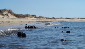
Sediment cores were analyzed to determine storm and sea level history. Radiocarbon dates of bivalve microfossils indicate that Waquoit Bay was first inundated by marine waters approximately 3600 years ago. The ongoing research will help decipher the relationship between sea-level rise, storminess, and the inundation of terrestrial ecosystems and will help to illuminate what caused the drowning of the South Cape Beach paleoforest.
Using Molybdenum Concentration in Estuarine Sediments as a Proxy for Hypoxia Occurrence and Frequency
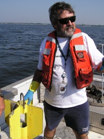
PI: Warren Boothman (EPA)
Description: With the assistance of the Waquoit Bay Reserve, staff from the Atlantic Ecology Division of the U.S. Environmental Protection Agency’s National Health and Environmental Effects Research Laboratory are examining the relationship between the frequency of hypoxia (low dissolved oxygen) in marine waters and accumulation of molybdenum (Mo) in sediments underlying those waters. Previous research in Narragansett Bay (RI) has shown that Mo accumulates in sediments when the water above becomes low in oxygen and revealed a linear relationship between the total period of hypoxia and concentration of Mo in surface sediment. To test whether the relationship is valid over a wider spatial scale, the same analyses are being done at monitoring sites within Waquoit Bay that have more than a decade of water quality data. Research chemist Warren Boothman (EPA) and Chris Weidman, Research Coordinator at the Waquoit Bay NERR, collected 12 sediment cores from 4 sites in May that will be sliced into 1-cm thick sections and analyzed for Mo. Results of the chemical analyses will be combined with historical records of dissolved oxygen to determine whether the Mo-DO relationship found in RI is also valid in coastal water bodies in MA and presumably elsewhere. In addition to examining the Mo-DO relationship in recent years, vertical profiles of Mo in the cores could develop a historical perspective on the frequency of hypoxia in Waquoit Bay.
For more information on this research, contact Warren Boothman (401-782-3161, boothman.warren@epa.gov).